


By Chryshane Mendis
Dimbulagala is a large isolated mountain situated in the North Central Province, east of Polonnaruwa. Its history dates back to the early historical period of Sri Lanka and was home to a Monastic complex during the Anuradhapura and Polonnaruwa periods. Dimbulagala is presently most famous for the Dimbulagala Rajamaha Viharaya and its late chief incumbent the Ven. Sri Seelalankara Thero who had served the people of Dimbulagala for decades but was murdered in 1995 by the LTTE.
Location
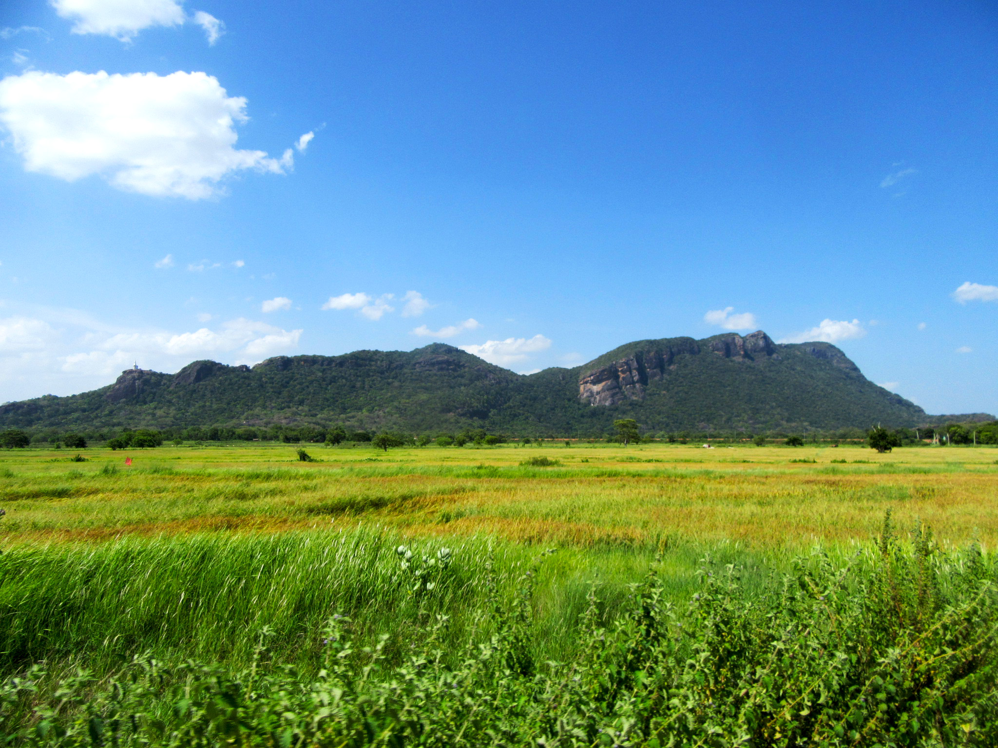
The isolated mountain of Dimbulagala or ÔÇÿGunnerÔÇÖs QoinÔÇÖ, located in the dry zone of Sri Lanka is made up of two main rock formations stretching east to west and rises 530 m to the east and 510 m to the southwest. The southern face of the rock ends in a sheer rock precipice with gradual slopes to the north and west. Dimbulagala contains a Dry Monsoon forest cover is surrounded by paddy fields and scattered large tanks. Dimbulagala borders the Mahaweli Ganga with the Flood Plains National Park to the west, Manampitiya to the north and Aralaganwila to the south. It is about 250 km from Colombo and can be reached from Polonnnaruwa by traveling east along the Batticaloa road and turning right from Manampitiya junction to the Manampitiya-Aralaganwila road and from there turning right from Dalukkane junction. The Manampitiya-Aralaganwila road covers the eastern face of the mountain while the Mahiyangana-Dimbulagala road starting from Dalukkane junction covers the northern and western faces. Further a minor road covers the southern face linking the above two main roads.
Mountain in folklore and history
Dimbulagala first associates its self with King Pandukabaya in the 4th century BC. Known as Dhummarakka Pabbata in the Mahawamsa, it is stated that prince Pandukabaya during his war with his uncles encamped in the forests of Dhummarakka Pabbata for four years. During his stay here he captured a Yakkini named Cetiya who dwelt in the mountain in the form of a mare, who helped him from there on in his campaigns. The large number of drip ledge caves with Brahmic inscriptions dating to the 3rd to 2nd centuries BC and other ruins of the Anuradhapura period indicate its function as a monastic complex from early times. According to the Chief incumbent of the Namal Pokuna Temple, the Arahat Kuntagantatissa thero who after recording the Tripitakaya at the Matale Aluvihara in the 1st century BC retired to this mountain which was then furnished under the patronage of King Valagamba.
Dimbulagala next comes to prominence during the Polonnaruwa period, during which time it was known as Udumbaragiri or the Mountain covered in mist. An inscription at the site of Mara Vidiya in Dimbulagala states that Sundera Maha Devi, the wife of King Vickramabahu I (1111-1132 AD)  had contributed to the development of the monastic complex here. It is next mentioned as the residence of the Maha Thera Kashapa during the reign of King Parakramabahu the Great (1153-1186 AD), who presided over the council held for the discipline of the Sangha which is inscribed in the Polonnaruwu Katikava at the Gal Vihara. The learned monks of the Dimbulagala Aranya sect were further consulted during the reigns of King Vijayabahu II (1232-1236 AD) and King Parakramabahu II (1236-1271 AD) for the disciplinary reforms of the Sangha.
It is believed that with the fall of the Polonnaruwa Kingdom, the monastery ran into decline and the area was soon taken over by the forests. According to the Chief incumbent of the Namal Pokuna Temple, along with the Kalinga Maga invasion, a drought plagued the area and thousand monks were said to have perished in an area on the banks of the Mahaweli Ganga nearby, which came to be known as Dahastota. Subsequently Veddas from Mahiyangana migrated to the area of Dimbulagala and were occupying the lands here when the Ven. Sri Seelalankara Thero arrived to build the Dimbulagala Rajamaha Vihara in the mid-20th century; their descendants are still found in the surrounding villages.
Ven. Sri Seelalankara Thero who arrived here in 1932 gained the confidence of the Veddas, who allowed him to build a temple at the present Namal Pokuna Viharaya; but was subsequently asked to leave the place by the Department of Archaeology. He then selected and established the present site of the Dimbulagala Rajamaha Vihara.
Archaeological sites of Dimbulagala
The history of the forest monastery of Dimbulagala dates from the 4th century BC, and hence scattered throughout the mountain are numerous ruins of ponds, drip ledge caves with inscriptions, ruins of stupas and various other religious buildings. The archaeological sites of Dimbulagala fall primarily to five sites; the Namal Pokuna ruins, Mara Vidiya, Pulligoda cave paintings, Molahetiwelagala, and Kosgaha Ulpatha.
Namal Pokuna
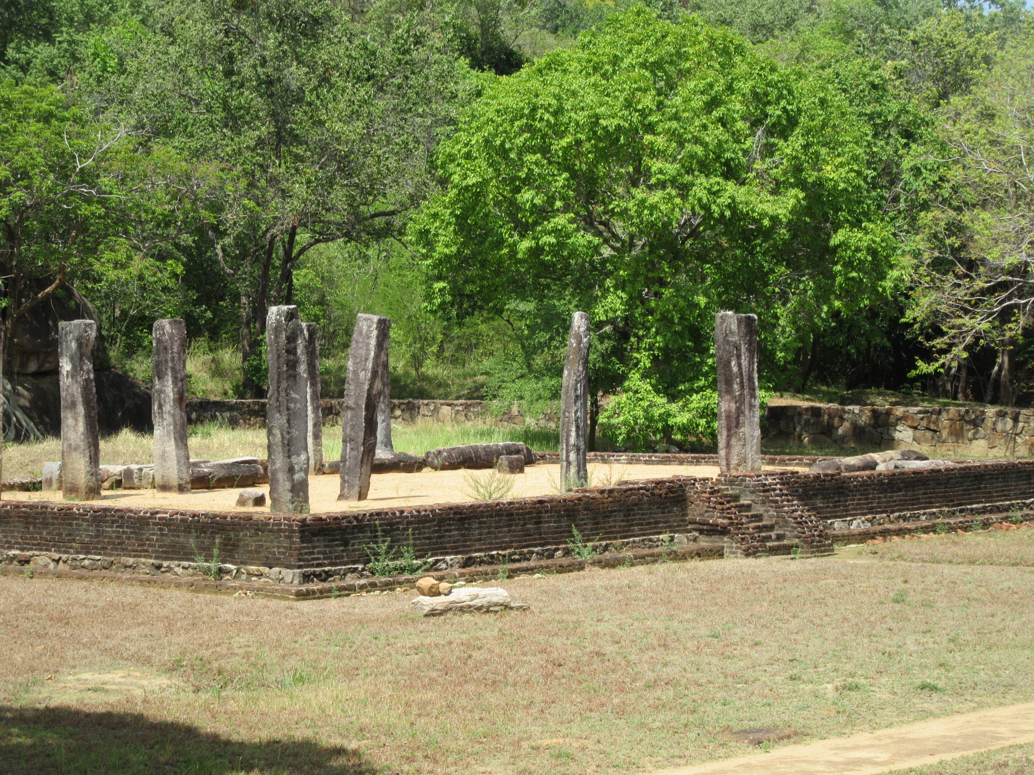
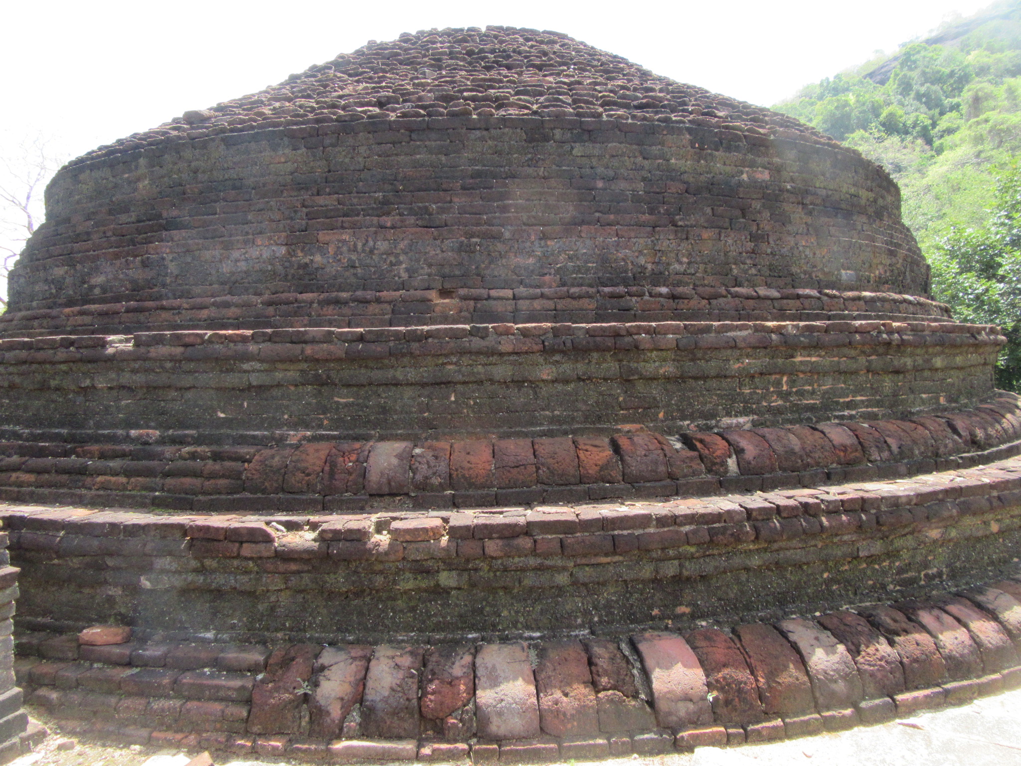
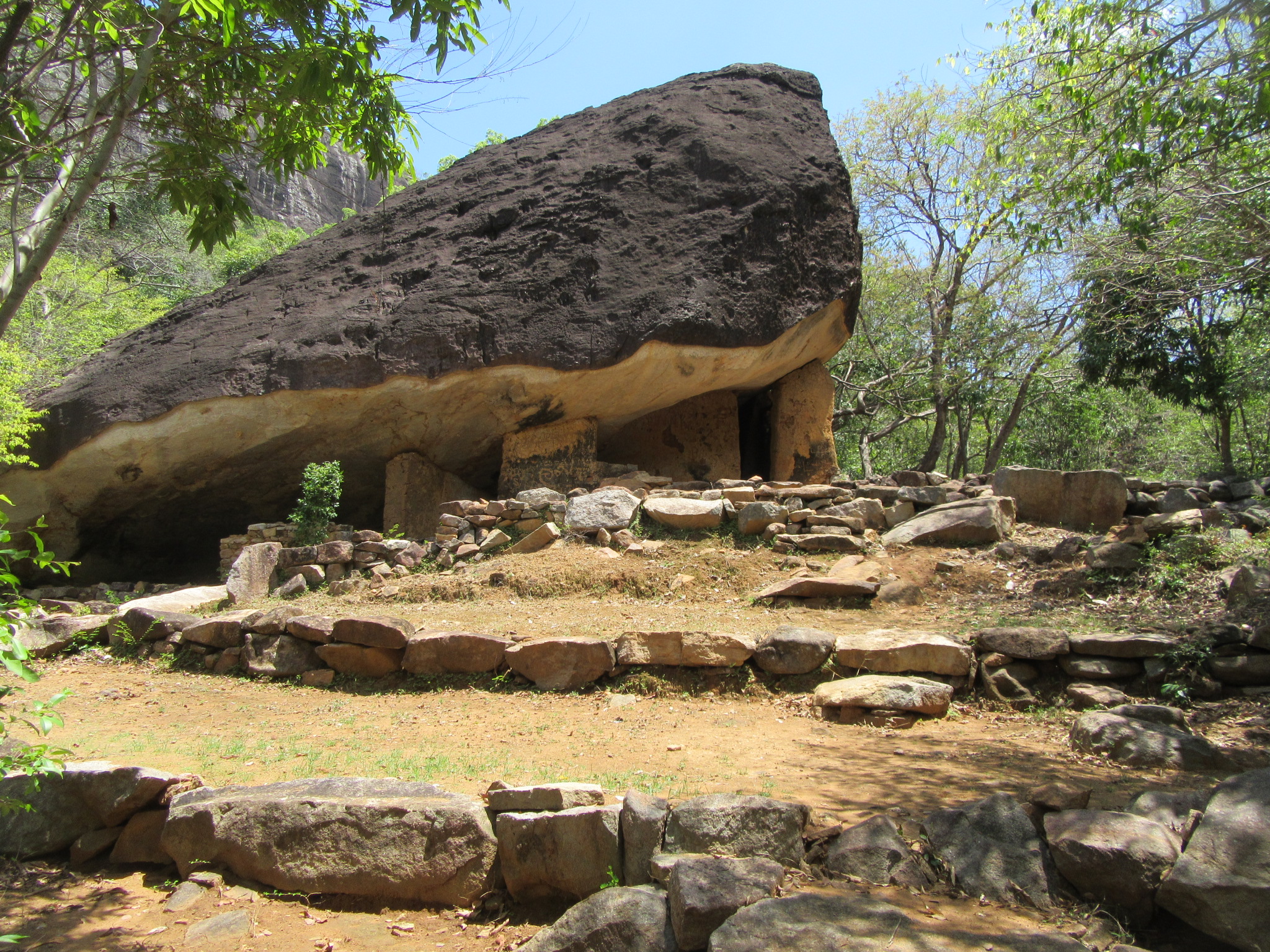
Namal Pokuna archaeological site is found on the northern side of the mountain, it includes a monastic complex comprising of an Image House, a Stupa, a Bo-tree shrine and an unidentified building surrounded by a granite parapet, and further south of these are found several caves scattered about the forest (with some containing inscriptions) and two ponds.
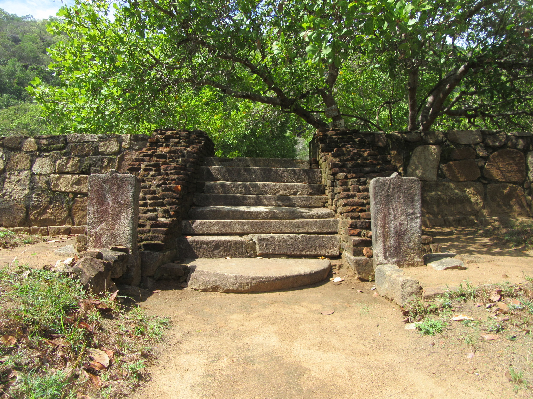
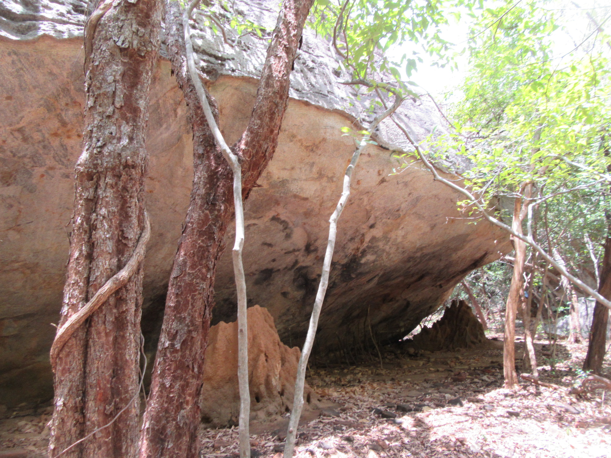
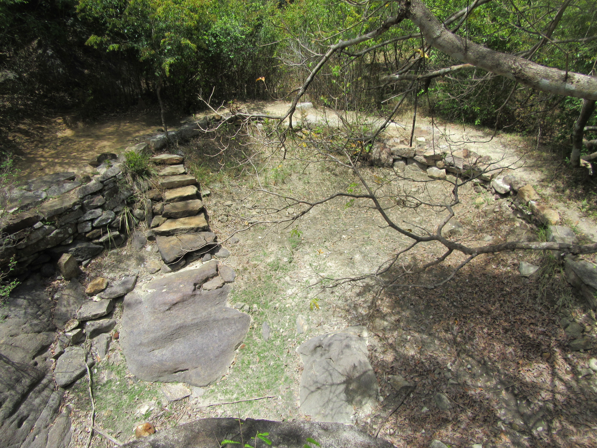
Entering through the modern Namal Pokuna Viharaya on the Mahiyangana-Dimbulagala road, one needs to walk 500 meters from behind the temple along a rock cut stairway on a large rock outcrop to reach the ruins. Walking past the rock outcrop and falling on to a foot path one comes upon a large granite parapet with an entrance. The stone parapet comprises of an ancient temple complex and found within it are the ruins of a Stupa, an Image House, a Bo-tree shrine and the remains of an unidentified building. The Stupa is built upon a 2 meter high platform with three entrances and only a portion of the dome has survived. The large Image House comprises of a large platform with a single entrance facing north. Situated in the center of the platform is the central building comprising of the entrance chamber and the shrine room. Within the shrine room can be found the remains of two Buddha statues, one of which only the portion below the knee and the pedestal survive and the other, which is found on the ground in front of this, is lacking the head and feet. These ruins along with the Bo-tree shrine and the unidentified building remain in a good state of conservation and their architectural features places them to the Anuradhapura period.
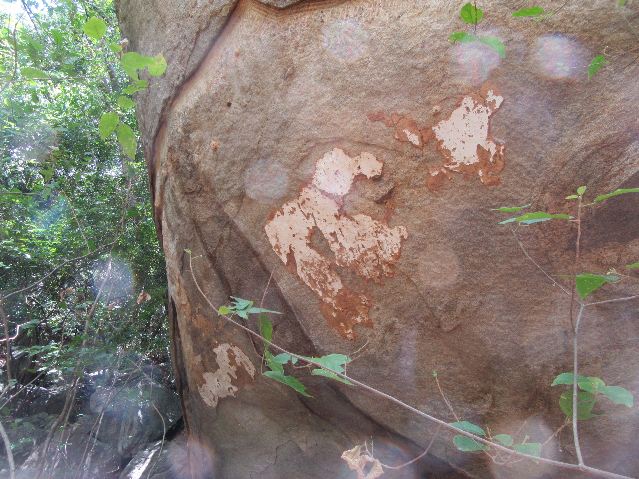
From the entrance of this ruined complex to the right, along the western parapet is an opening from which leads the path further to the rest of the sites. Immediately outside of the parapet can be found the remains of a large pond, according to folklore it is this pond that is called the ÔÇÿNamal PokunaÔÇÖ, from which the entire site derives its name. Just above the pond is a small single-slab stone bridge over the tiny stream entering the pond; and from the bridge the path continues to the caves and other sites. In the vicinity of this pond can also be found traces of other ruins. The path from here continues at a slight ascent through the relatively low shrub forests with thin undergrowth. Walking several dozen meters from the stone bridge, a small flight of steps could be found to the left leading down; in this boulder strewn area are three caves with drip ledges. ┬áTwo of the caves are made on either side of one large rock, while the third cave contains just below the drip ledge an ancient Brahmi inscription reading ÔÇÿthe cave of Asha ShamanaÔÇÖ. On this cave could be found traces of plaster which once may have contained paintings. Further traces of the walls that would have once built up the chambers to these caves could still be seen.
Continuing along the path one arrives at the pond known as the ÔÇÿNil Diya PokunaÔÇÖ; this is named so due to its water being blue despite its contamination with leaves and other organic material. This pond is filled by the rain water and runs dry during the dry months. To the right of this pond is another cave with the chamber walls still intact to a certain extent.
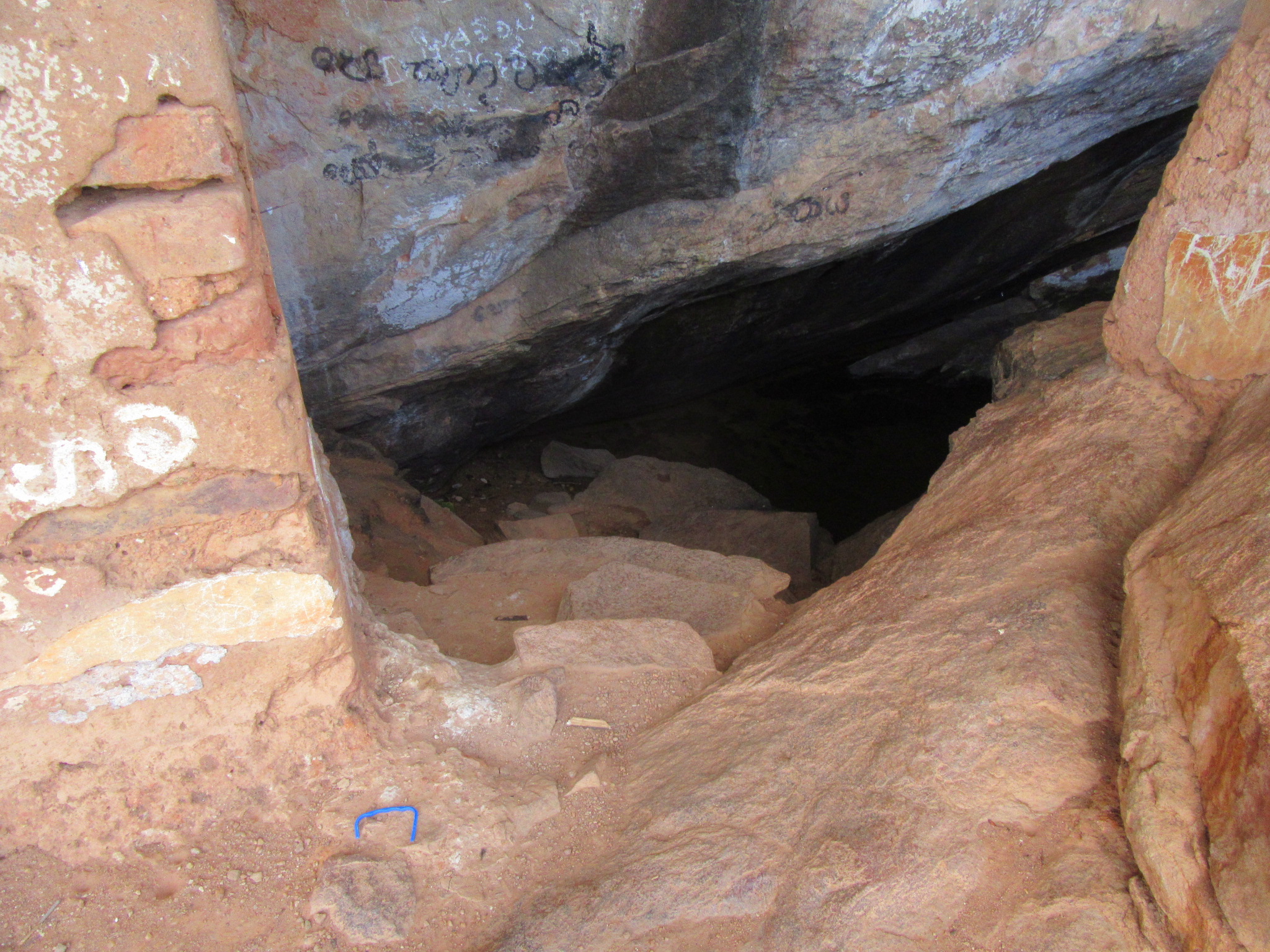
Continuing few meters ahead one arrives at a large cave known as the ÔÇÿKashapa LenaÔÇÖ or the Cave of Kashapa, thought to be the dwelling place of the Maha Thera Dimbulagala Kashapa of the 12th century AD. This cave comprises of four chambers with the chamber walls perfectly preserved. In the large chamber, the window in the wall and a bed made of plastered stone and mud could still be seen. It is sad that the plaster on all these walls have been defaced by the scribbling of tourists who visit this place. Upon this cave too could be found an ancient Brahmi inscription denoting the name of a donor. The Chief incumbent of the present temple mentioned that there were two urinal stones found in the vicinity of this cave as well.

From here the open path turns into a forest trail with large trees and boulders providing a shady canopy from the sun. Although the path is less visible, arrows have been painted on several rocks indicating the direction. From here it leads to the other sites of the Ahas Gawwa and the Mara Veediya and the Aushada Pokuna.  
Mara Vidiya
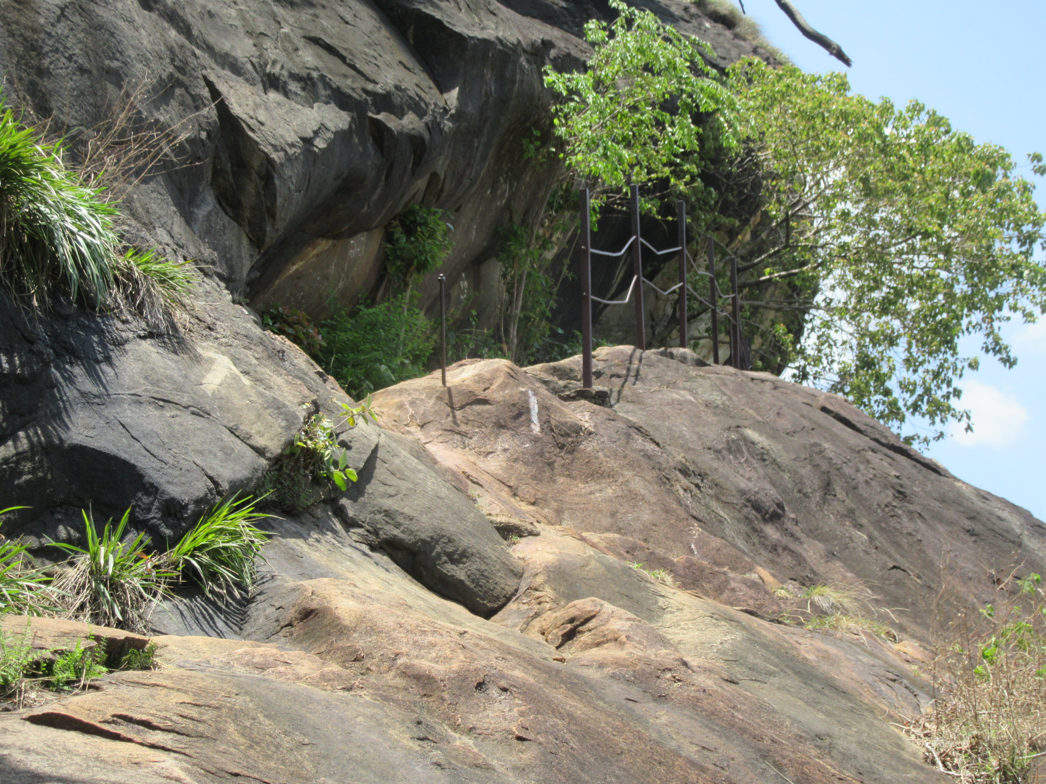
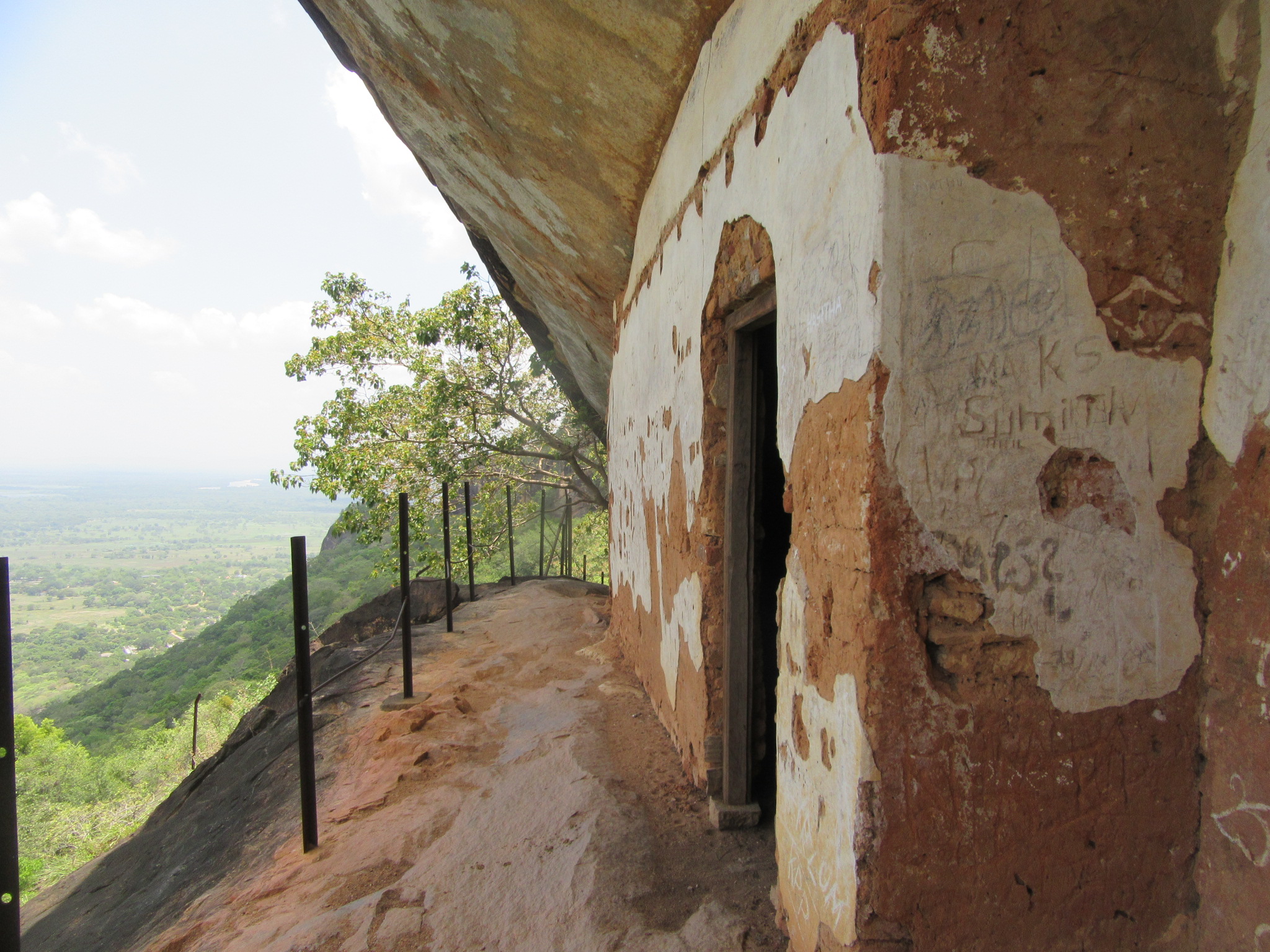
This is a cave complex situated on the southern face of the rock high above the ground level. The name Mara Vidiya or ÔÇÿDeathÔÇÖs PathÔÇÖ is given due to the dangerous climb and path on which these caves are situated. This can be accessed from either Namal Pokuna or from the Dimbulagala Rajamaha Viharaya. The path from Namal Pokuna as stated above enters the forest from the Kashapa Lena and heads south west from where there is a steep climb to the summit of the mountain and from which one needs to climb down along the southern face of the mountain to arrive at its trail head. The trail from the Rajamaha Vihara is much shorter as it is situated at the southern edge of the south face of the mountain. Passing behind the meditation chambers of the Viharaya, one climbs upon an open rock face; the path is made visible by painted arrows on rocks and after a considerable climb one enters the forest on the southern face and from here begins a steep climb up the natural rocks studded path. After about 300 meters from the point of entry to the forest one would come upon a rectangular platform across the path made of stone, from here a smaller path branches off to the right at very steep angle; this is the trail head to the Mara Vidiya. 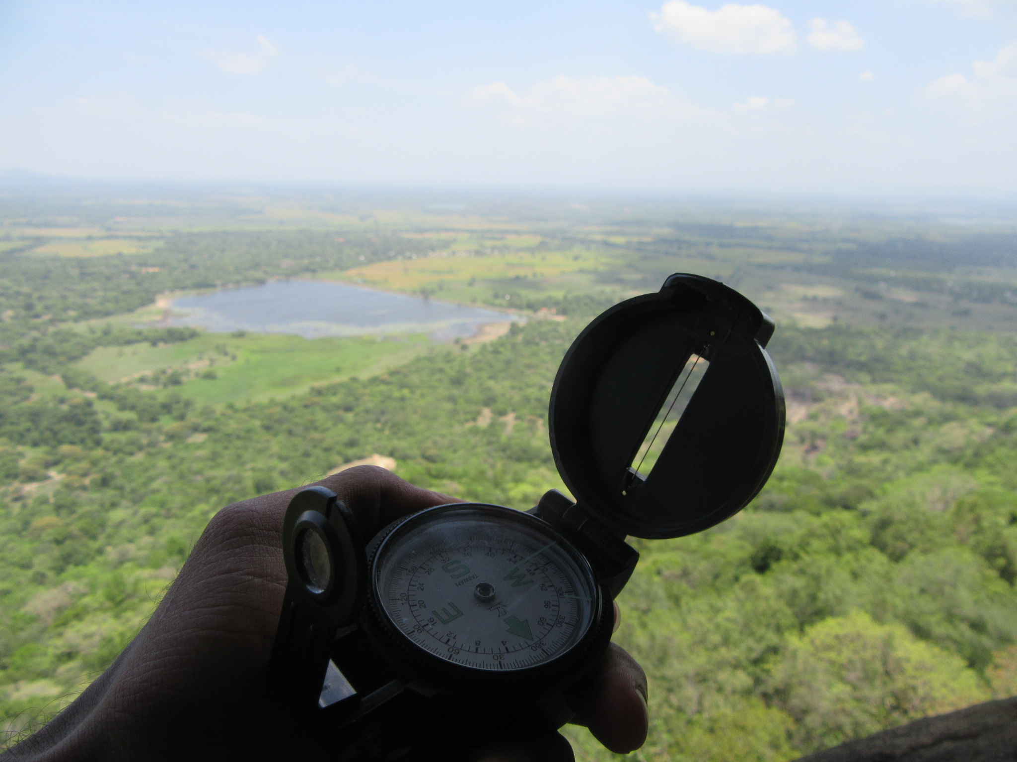 Climbing this steep path for about 200 m one enters to a small path along the edge of the cliff with a stunning view of the plains south of Dimbulagala.
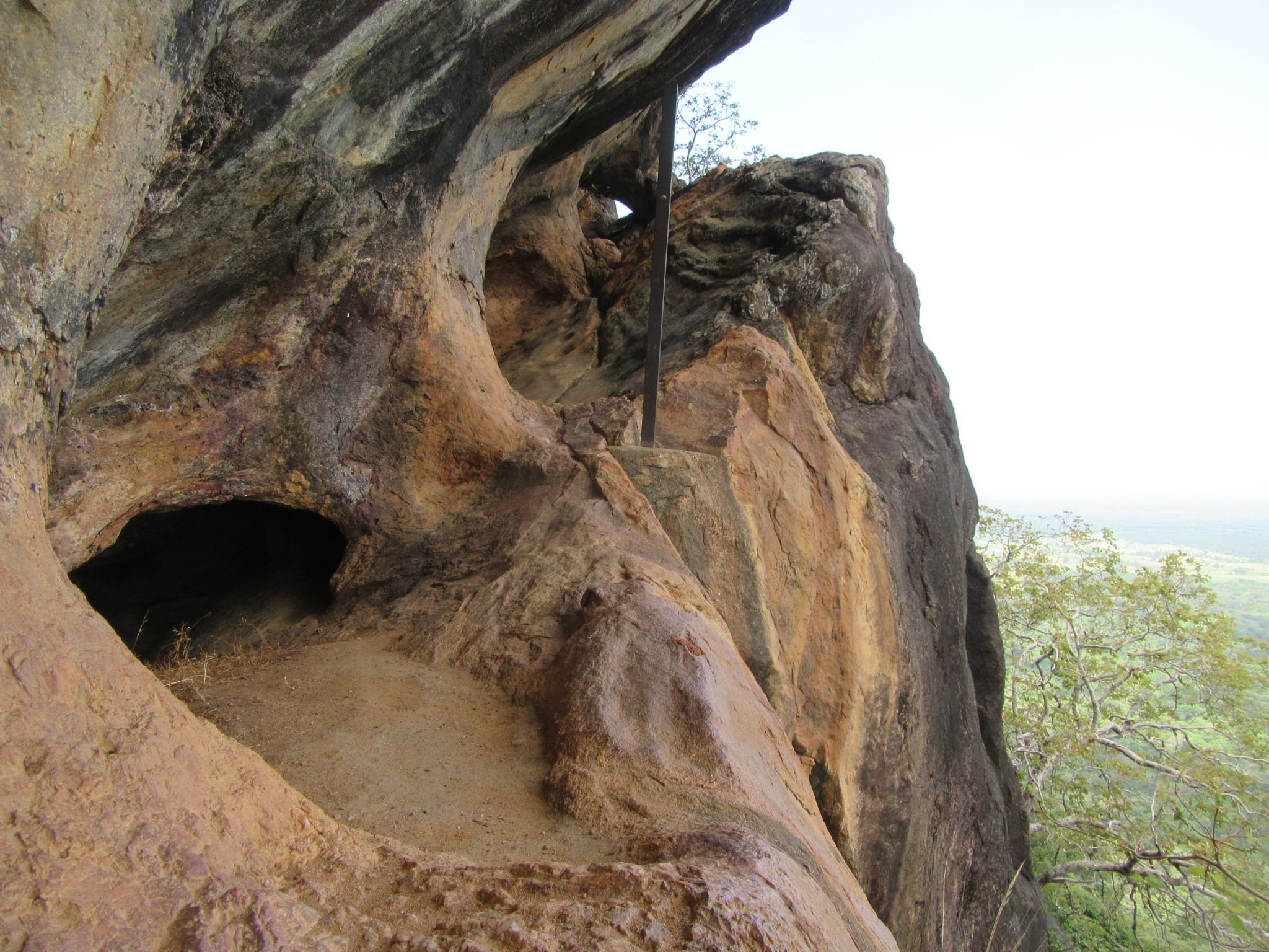
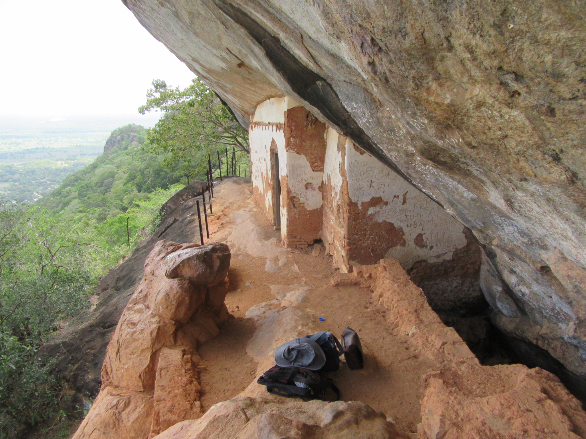
Beginning from here are sections of an iron cable installed to aid climbers leading to the first cave. This first cave is divided into four chambers with the walls in a good state of preservation; but which has not escaped the vandals of modern times whose scribbles dot the entire plaster. Found next to these chambers about four feet below the path and between the rock face is the pond known as the Aushada Pokuna or the Herbal Pond, this contains water which is said to never run dry. Passing the Herbal Pond and climbing further is a series of tunnels created by the action of the wind. The iron railings installed here have broken away making the passage through these dangerous. As the path along the edge of the cliff and these tunnels turns to the left, one comes across another chambered cave with traces of paintings. Also found here in the Mara Vidiya is the perfectly preserved inscription of Sundera Maha Devi, wife of King Vikramabahu who had given royal patronage to this place. The stunning site of Mara Vidiya gives a more-than satisfying ambience for meditation and is thus not hard to see why this place, so hard to access, was chosen to build the meditation chambers.
The next article will feature the other sites of Pulligoda, Molahetiwelagala and Kosgaha Ulpatha along with the list of bibliography…
The tour of Dimbulagala was conducted by Chandima Ambanwala, Sameera Prasanga, Buddhika Konara, Chamal Senadheera, Kasun Darshitha, Asanga and myself in August 2017 as part of a survey of sites in Polonnaruwa.
its a very nice place, and the very different pic you got. very helpful information