


Chryshane Mendis
Program Coordinator, archaeology.lk
Introduction
This series ÔÇÿKotte HeritageÔÇÖ would explore the archaeological and heritage sites of the Kotte Kingdom. Kotte, before becoming the Capital in the 15th century was first developed as a fortress in the late 14th century by Nissanka Alakesvara to serve as a base for his attacks on the Arya Cakravarti of Jaffna. In 1415 with the ascension of Parakramabahu VI as King, Kotte was selected as the Capital due to its superb fortifications and expanded into a beautiful city with further fortifications. Kotte served as the Capital of the kingdom till 1565 when the Portuguese who were defending the Kingdom on behalf of King Dharmapala decided to relocate the city to Colombo due to the continuous attacks from the Seethavaka Kingdom under Rajasinghe I. It is stated that they demolished all the buildings and used the material to expand Colombo.
What remains of the city at present and commonly known are the Veherakanda ruins, AlakesvaraÔÇÖs palace, some ruins at Parakumba Pirivena, the tunnel at Ananda Sastralaya, the Inner and outer moats and sections of the rampart. There are traces of other ruins within Ethul Kotte and Pita Kotte which belong to the fortress but which are not quite known and not conserved. This series will explore all known and unknown historic sites and the legends surrounding them.
The Inner-city and Outer-city
In order to get a proper understanding of the purpose of the tunnel systems it is important to know the city limits. As stated above the city of Kotte developed as a fortress and grew into a fortified city. The historic development of the fortifications of the city of Kotte could be seen in two stages, the first stage by Nissanka Alakeshvara and the second by King Parakramabahu VI. Throughout these two stages of development, various defense systems were constructed such as ramparts, bastions, moats, and various others (this series would explore each of these features in the future). During this development stage a network of tunnels was constructed for the security of the fort.
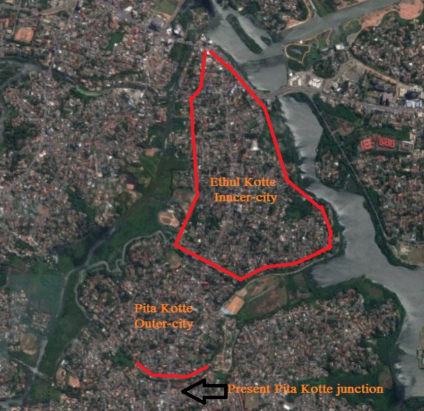
The fortified city was divided into two sections, as the inner-city and the outer-city, this is still known at present as Ethul Kotte and Pita Kotte; and access to the city was through 7 passes with the only land pass being at Pita Kotte which was about 200 feet wide and was heavily fortified by Alakeshvara and later by the Portuguese as well.
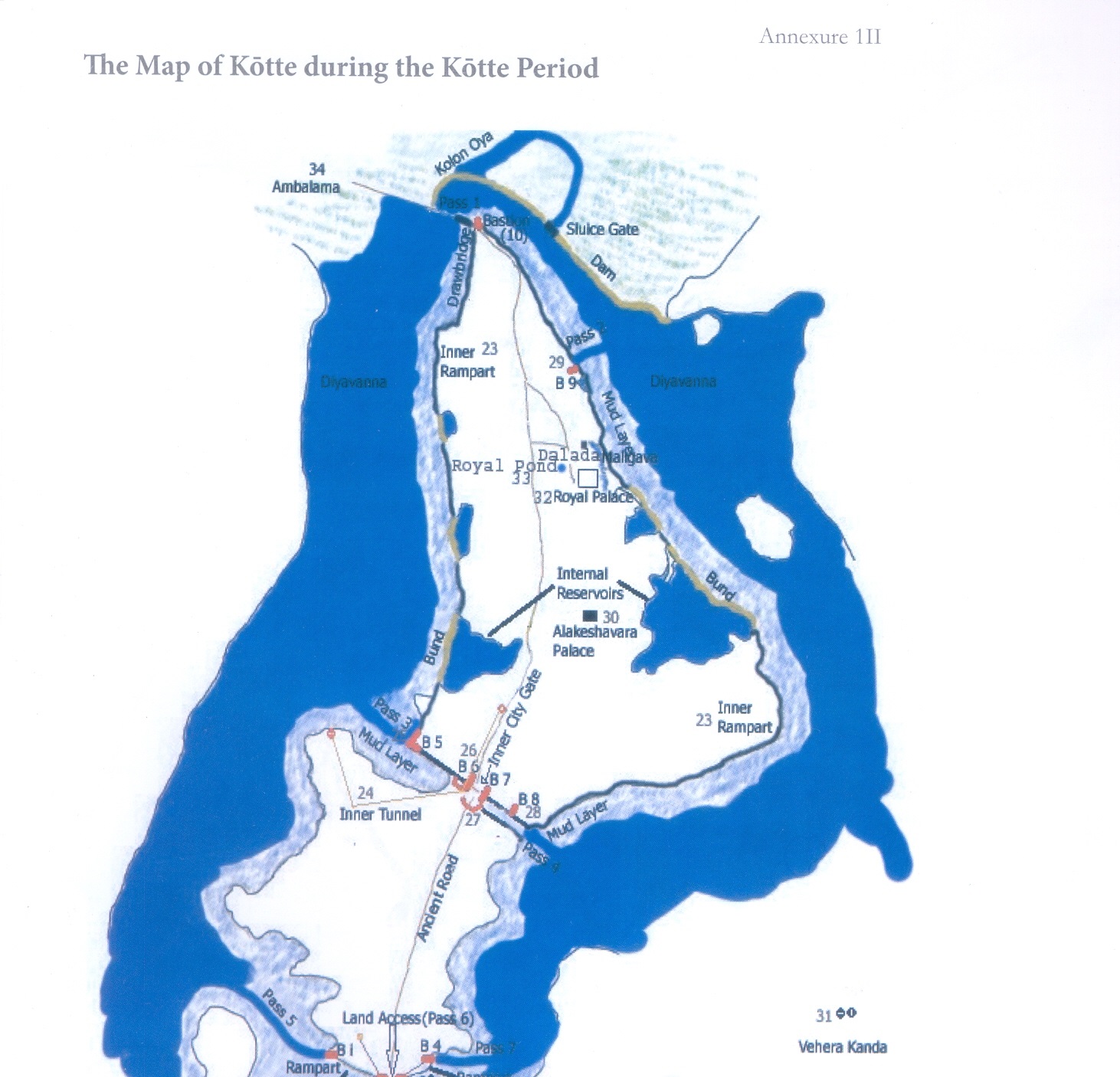
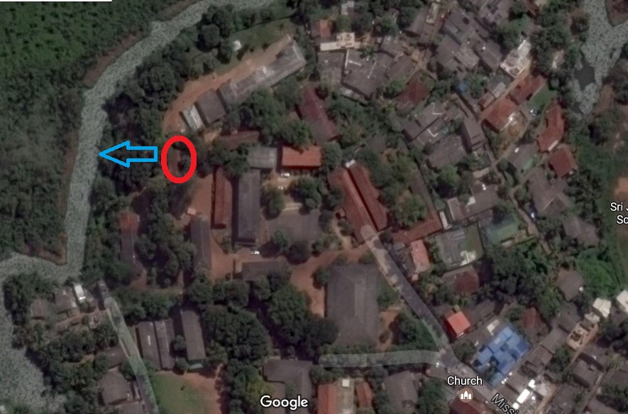
The area of the inner-city at present comprises of the land, from the north at the entrance to Ethul Kotte road from Parliament road to the south near the Salvation Army church on Ethul Kotte road and from the east, from Nippon Avenue to the area bordering the Kolonnawa Canal in the west. The inner-city gate was found in the area where the Salvation Army Church is, which is less than 100m to the south from the Kotte Archaeological Museum. The area of the outer-city comprises the area between the inner-city gate up to the Sirikotha which is about 80m before the Pita Kotte junction. This was the main land pass to the city. With this context, we could now look into the tunnel network with a clearer mind of the surroundings.
The Inner-City tunnel
Tunnels are an important feature of a fortification which serves as an escape for the occupants under a siege and also to attack the enemy by surprise. The fortress of Kotte was equipped with such a tunnel system. The fortified city of Kotte was equipped with two tunnel systems, one for the inner city and outer city.
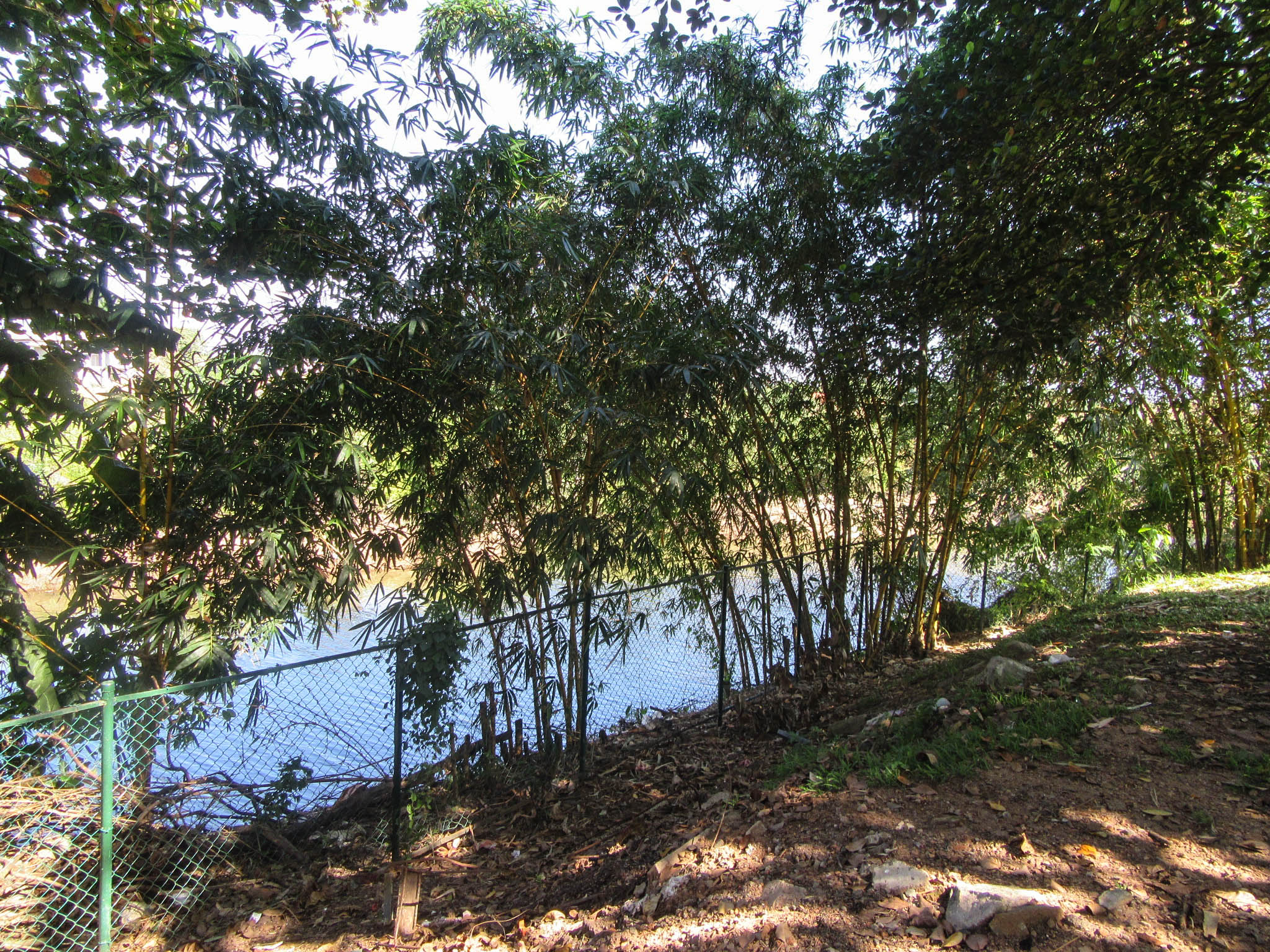
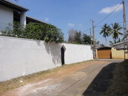
The inner city tunnel was said to have been built by King Parakramabahu VI. It functioned as an escape route with its entrance inside the city and exit leading to the lake where people could easily take boats to the other side. It is rumored that the entrance to the tunnel was through a well inside the city. The exit of this tunnel network was to be found until recently in the premises of the Christian Mission College down Mission road now known as Sri Jayawardenapura Maha Vidyalaya.
The writer on the 4th February 2017 visited the College premises with Mr. Saliya De Silva, Council member of the Kotte Heritage Foundation, a resident of Kotte and old boy of the College. Mr. De Silva knew the location of the exit of the tunnel which was accessible during his school days. Walking towards the Primary section of the school near the lake which was a considerable drop in elevation, he pointed towards a stone wall and explained that the exit was found here. He states that the opening was about 5 feet in diameter and ran several meters inwards. This was visible in the 1960s during their school days but was subsequently sealed off as it posed a danger to students who might venture in. Judging from the surroundings, it was an ideal place for an exit of a tunnel as the terrain formed a ditch-like feature giving cover to the escapees. And its close proximity to the lake about 20 feet from the opening was ideal for an escape over the lake as the surrounding higher elevation and trees would made it hard to escapees to be seen.

Climbing the higher ground and heading towards the school Mr. De Silva pointed to a location and explained that there used to be a Tennis Court during his school days were in the corner a certain section of the tunnel was revealed. This has been mentioned in the Administrative Report for 1968-70 of the Department of Archaeology. As at present, no visible location of the Inner-city tunnel exists.
Apart from this, there are few sites within the school of notable historic significance.
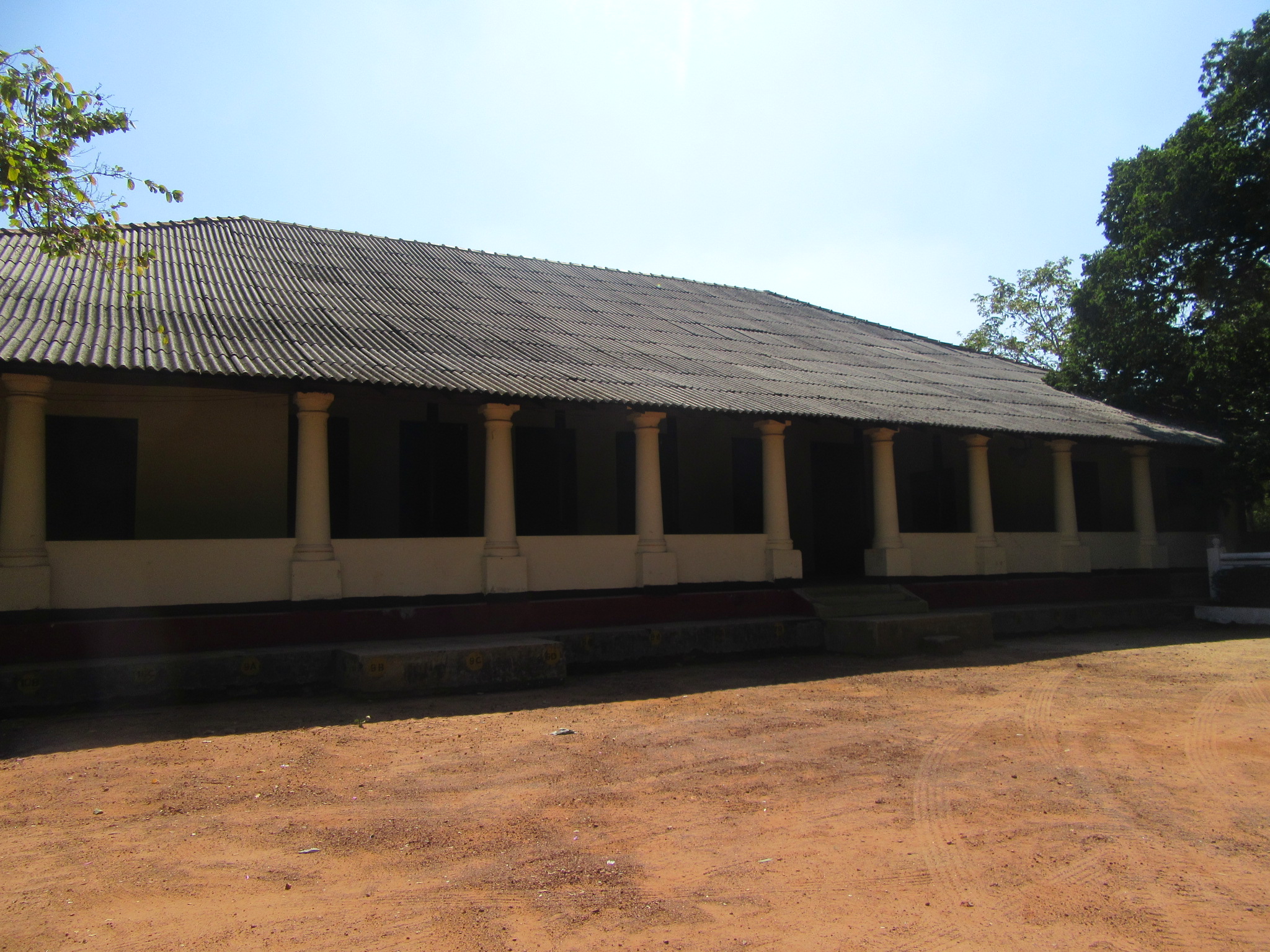
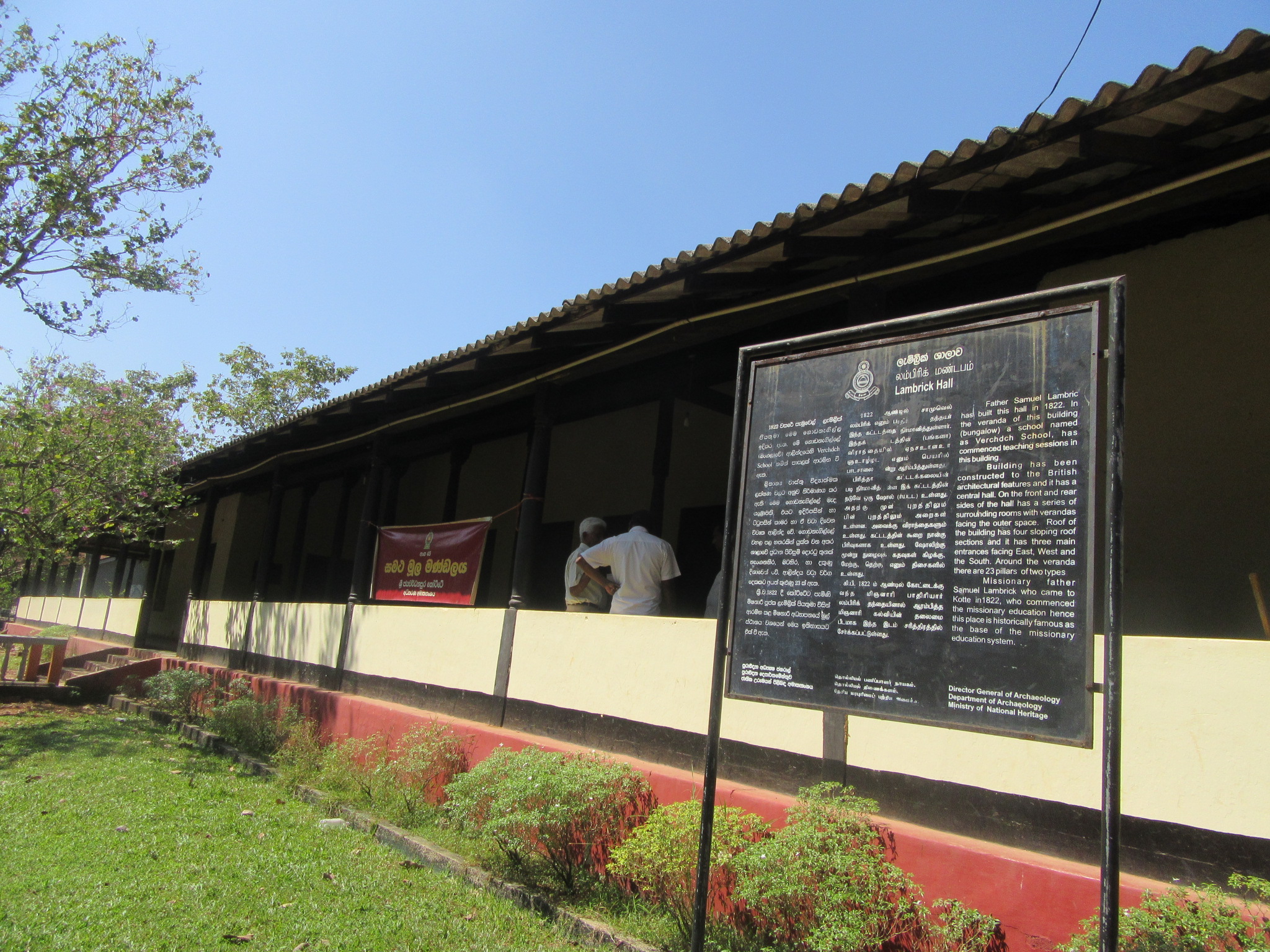
The Lambrick Hall
This massive Hall was constructed in 1822 by the Rev. Samuel Lambrick when he established the ÔÇÿCotta-InstituteÔÇÖ providing Christian missionary education by the Church Missionary Society. In time this came to be known as the Christian Missionary College and now Sri Jayawardenapura Maha Vidyalaya. This is perhaps the oldest School in Sri Lanka still in existence. This hall is built of typical Bristish-Ceylonese style architecture with massive columns and corridors and characterised by a large single roof. The roof has been renovated in recent times but the columns and the wooden doors and frames bears witness to the beautiful architecture of the 19th century. This is protected by the Department of Archaeology.
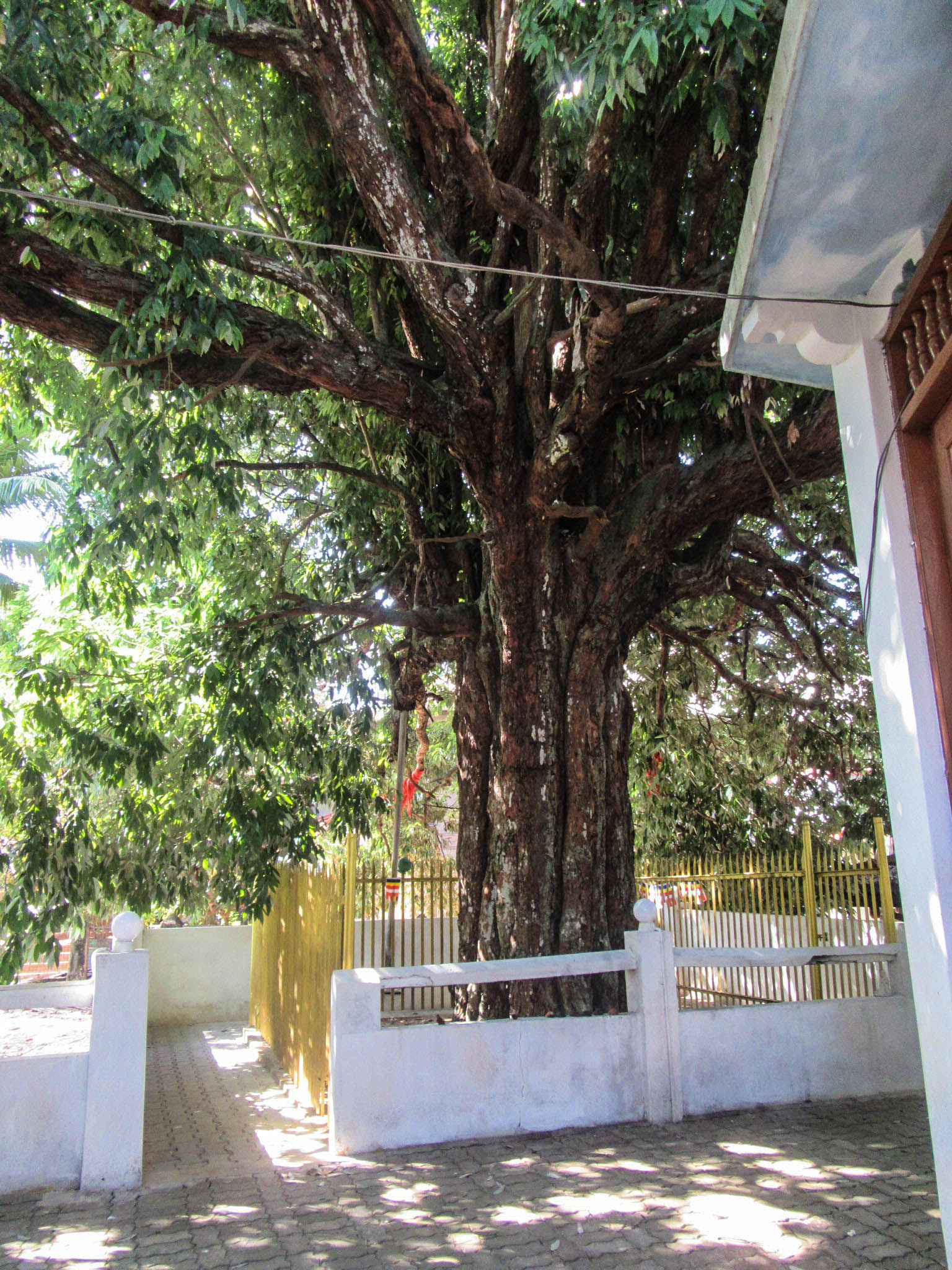
The ancient Na-tree (ironwood tree)
Adjoining the hall is an old Na tree said to be over 1000 years old. Legend states that the Ven. Sri Rahula wrote the Salelihini Sandesaya under this tree; no historical or archaeological evidence is found to support this claim but it is believed that this land in the which the present school is, was known as ÔÇÿErabath-TotaÔÇÖ during the recent past. It is also believed that during the days of Kotte kingdom it was the seat of ancient learning known as the Dharma Rajika Pirivena. Since a Buddhist temple can be situated 500 dunu (bow) lengths away from the inner-city according to the Vinaya pitaka, there can be some truth in this legend. [The distance to the school premises from the inner-city gate is about 500 metres.]
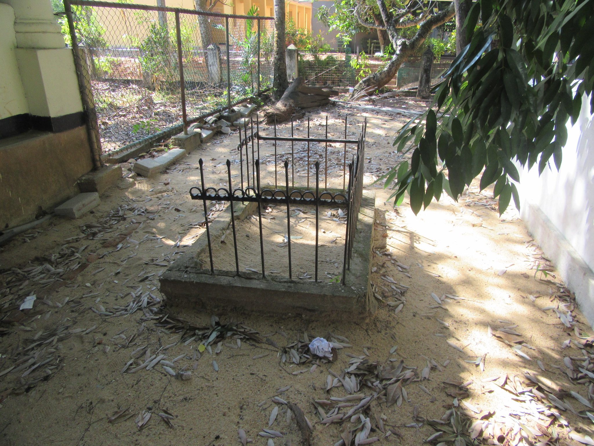
Kota Vehera
Mr Douglas Ranasinghe has shown in his map a Kotavehera by the side of Mission Road existed during mid-20th century. Kotavehera type dagabas are presumed to be tombs build for important persons. It is possible that this was built at the place where one of the air inlets of the tunnel existed.
Monument to the Son of Veera Keppatipola
Legend states that the son of Veera Keppatipola after his execution in 1818 was taken under British Missionaries and educated at this school where he lived in the hostel and had died due to a fever and was cremated within the school premises. In recent times a monument has been built to mark the spot where he is rumoured to have been cremated. This is right next to the old Na tree. There are no written records to prove this stated Mr. De Silva.
The writer would wish to thank the Principal Mr. D. A. D. Vanaguru for granting permission to document the historic sites within the school and is happy to note that he is keen in preserving these ancient monuments; and also to Mr. Saliya De Silva for the guided explanation of the monuments.
The Outer City Tunnels
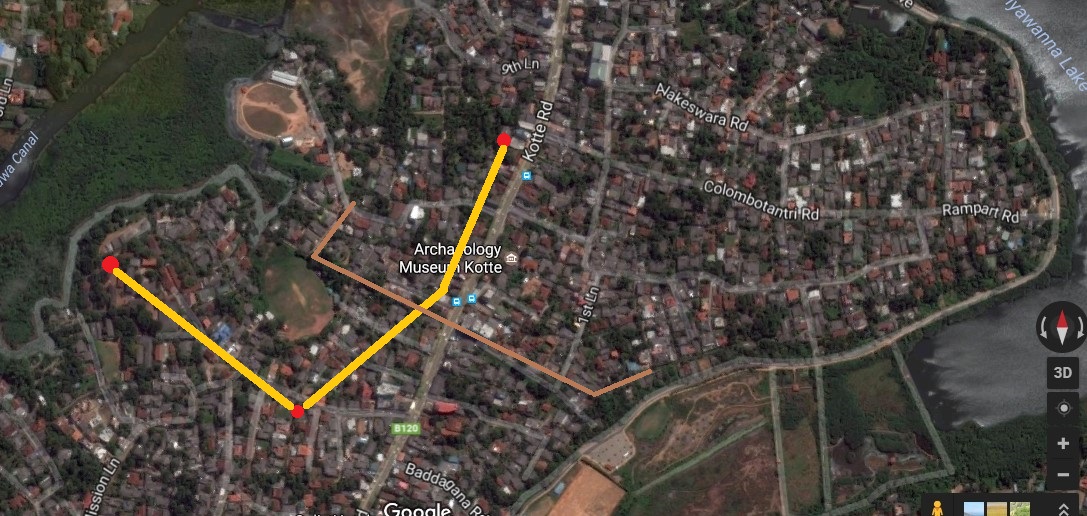
There were two tunnels leading from the outer-city built by Alakeshvara for defensive purposes. One being a small tunnel only sufficient for people to walk through and the other tunnel is said to be large enough for a horse to ride. Both these tunnels appears to have started in the outer-city behind the outer moat and fortifications and opened up at a tunnel junction in Pita Kotte with the small tunnel leading further south and opening at the ditch passed the Kotte Raja Maha Viharaya.
The smaller tunnel which had two sections began from the west of the main land pass and the first section opening up at the tunnel junction and the second section opening up further south. The Portuguese historian De Couto mentions an incident where during one of the sieges of Kotte by Rajasinghe of Seethawaka, that a Portuguese foraging expedition had discovered the forces of Rajasinghe hiding in the jungles outside the land pass and had used a tunnel to attack the rear of RajasingheÔÇÖs army which caused much damage due to the surprised attack. This shows that the small tunnel was in existence during the times of the Portuguese. The larger tunnel is said to have begun from the eastern corner of the outer rampart and opened up at the tunnel junction.
The Tunnel Junction
Interestingly this tunnel junction could still be found in the premises of the Kotte Ananda Sastralaya and is one of the most unique archaeological remains of Kotte. The Kotte Ananda Sastralaya is one of the most prominent schools in Kotte and could be arrived at by taking the small road to the left of the Gal Ambalama in Pita Kotte junction. The ruins are found within the school premises.
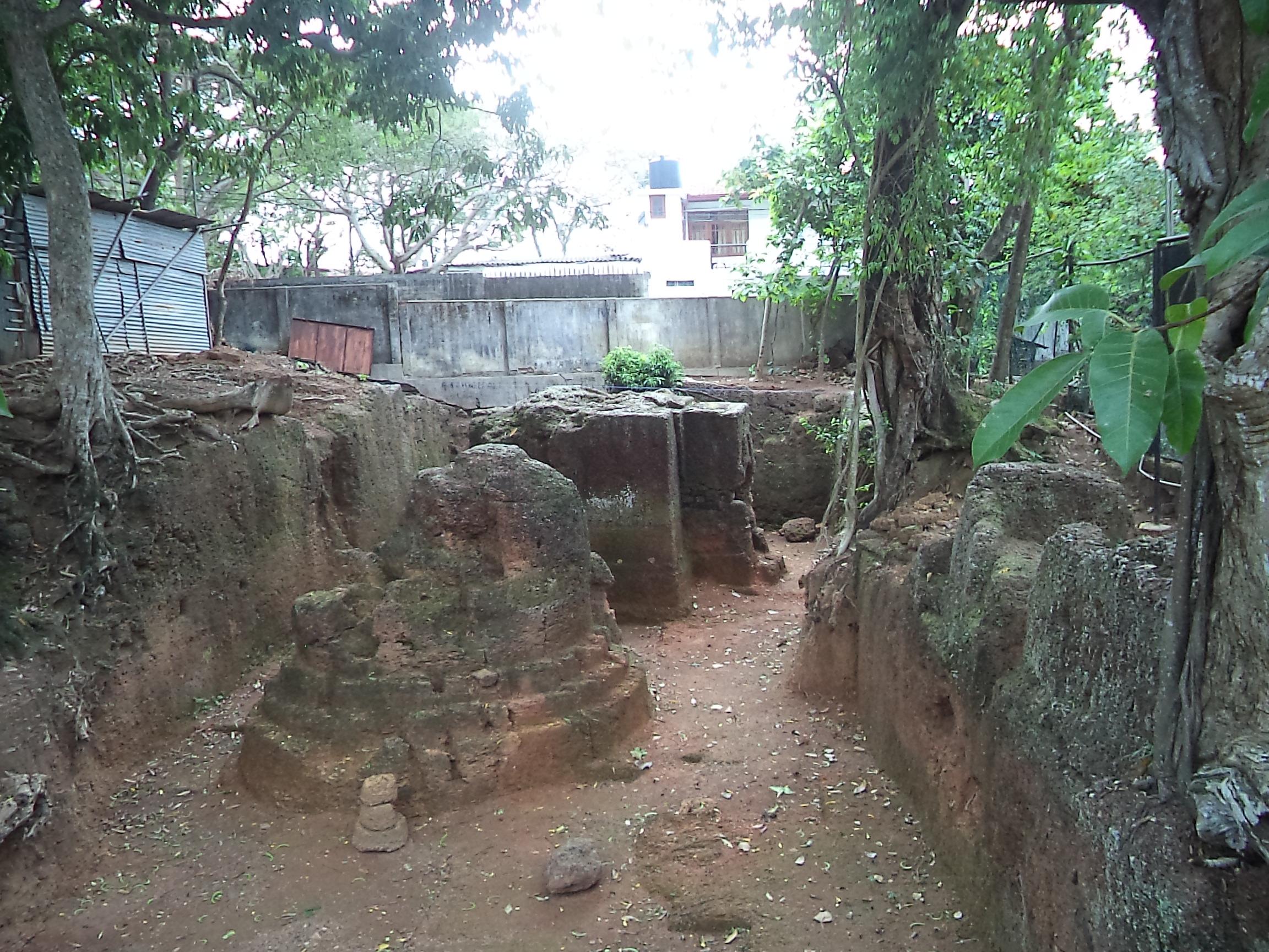
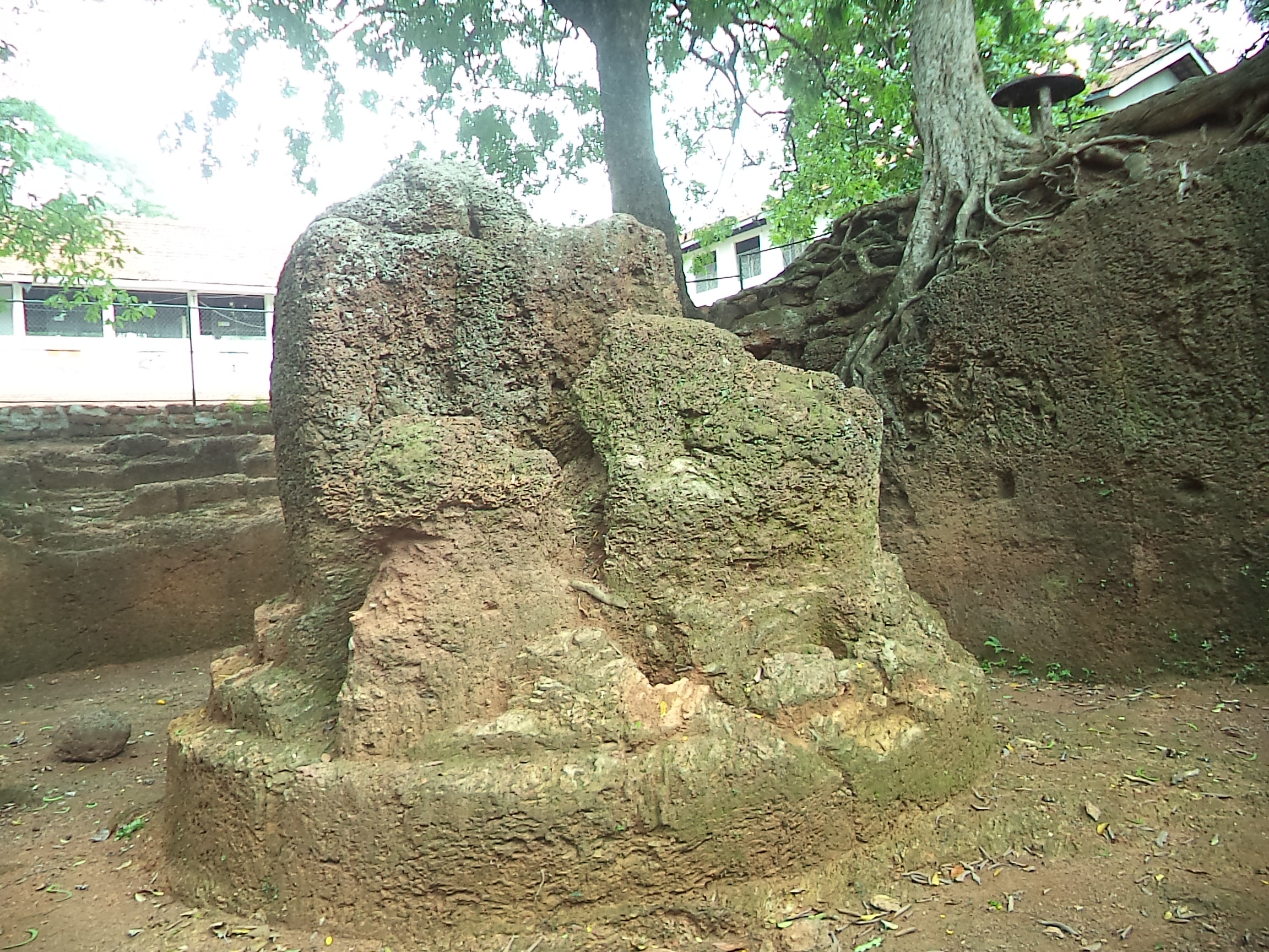
There are two large structures which are cut out of living cabook rock or laterite and what is most interesting is that these are found below the ground level. Once entered from the main gate of the school one could find to the right an area demarcated by a fence and within that gaze in amazement at the two massive structures in the ground. The entire area is about 10×5 meters and about 2 meters below the ground level. There are about 12 steps to get to the base level. The first structure is cut in the shape of a stupa and the second is a tall rectangular shaped structure with a decorated entrance portico extending outwards. The entrance portico is carved with a Makara Thorana and one could enter from here and exit from another opening in the rear. No tunnel could be found at present inside the structure which is a circular cavity with a pillar in the centre for support and one could barely stand inside. This structure is decorated right round with impressions of pillars and other designs.
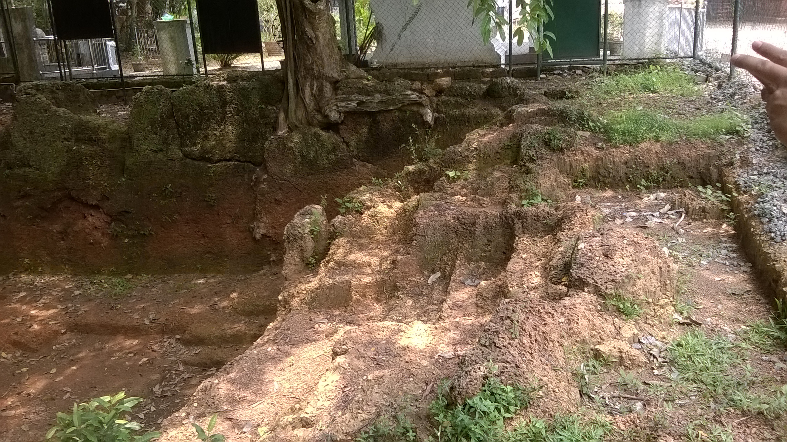
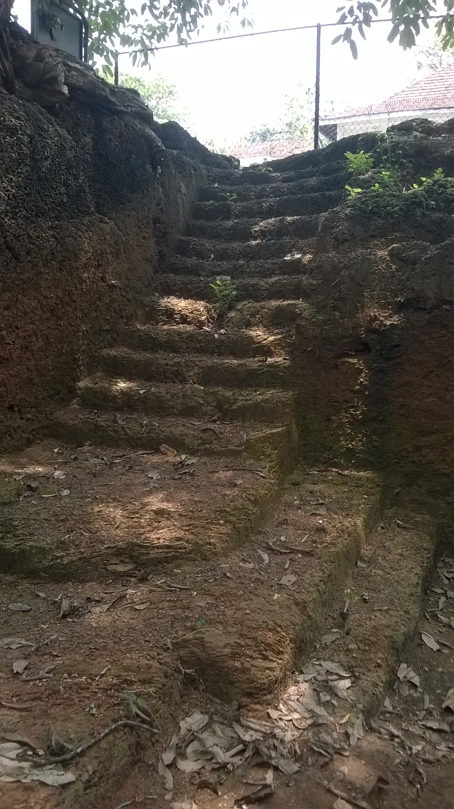
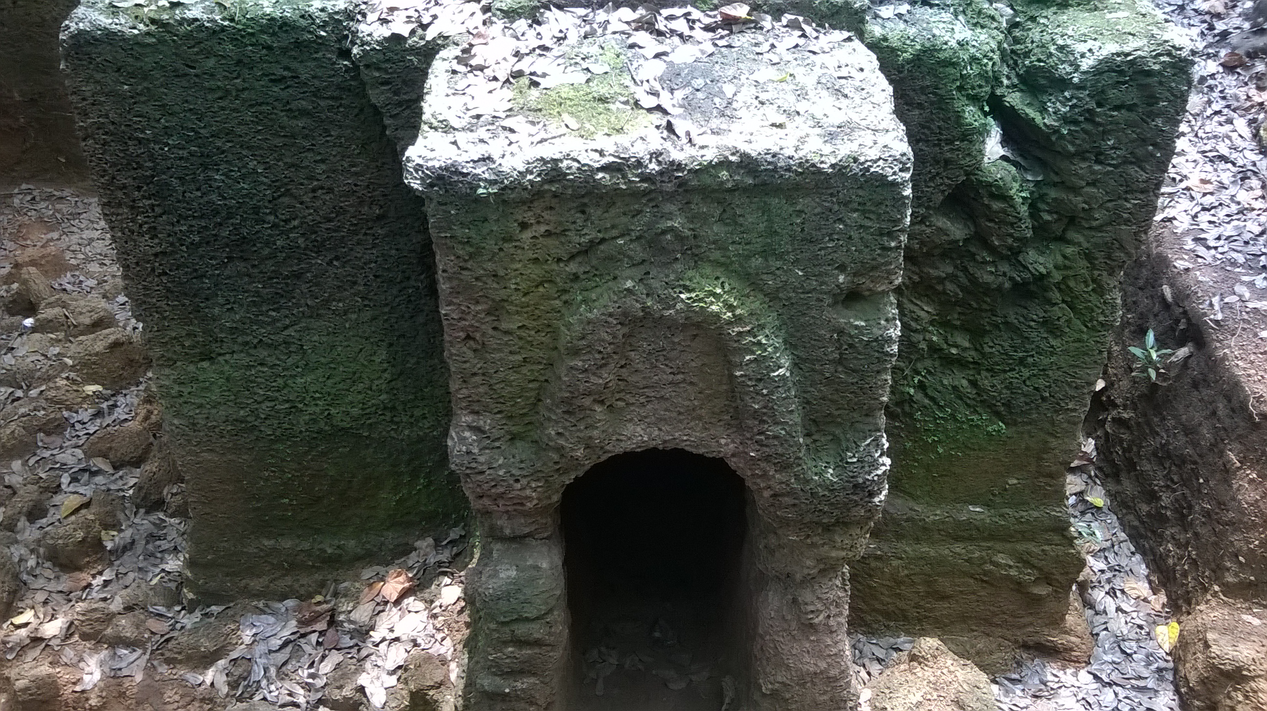
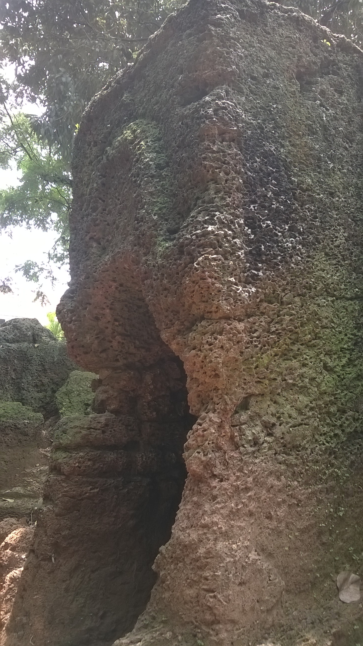
The archaeological reports date this site to the 16th century and state that the crown of the Sinhala Kings was believed to have been engraved on top of the entrance portico. This site was known to exist well into the 20th century as it and archaeological reports of 2011 states that this was covered by mud, exposing only a small section. Proper excavations were conducted in 2014 which revealed the real magnitude of this site. Although the excavations conducted here revealed no tunnel, a scan using Ground Penetrating Radar had revealed anomalies in the earth which could be the tunnel. Although no archaeological evidence can be found to prove this as the tunnel junction, its location being below the ground level and surrounded by trees makes it an ideal tunnel exit which would have given perfect cover for escapees.
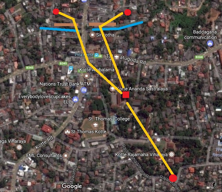
The exit of the smaller tunnel is said to be through a ditch south of the Kotte Raja Maha Viharaya but no visible location is found today.
References
- Fonseka Prasad, KOTTE: THE FORTRESS, 2015.
- De Silva, L.M.V., ÔÇÿWe are Many Centuries OldÔÇÖ, Sri Jayawardenapura Maha Vidyalaya 168th Anniversary Celebration, 1990.
- ÓÂÜÓÀØÓºÓÀèÓºÓÀÜ ÓÂ▒ÓÀÆÓÂ║ÓÀÅÓ©ÓÂÜ ÓÀâÓÀÉÓ¢ÓÀâÓÀöÓ©ÓÀè ÓÀÇÓÀèÔÇìÓÂ║ÓÀÅÓÂ┤ÓÀÿÓ¡ÓÀÆÓÂ║, ÓÂ▒ÓÀÆÓÂ║Ó©ÓÀö ÓÀâÓÀÉÓ¢ÓÀâÓÀöÓ©ÓÀè ÓÂÆÓÂÜÓÂÜÓÂ║, ÓÂ┤ÓÀöÓÂ╗ÓÀÅÓÀÇÓÀÆÓ»ÓÀèÔÇìÓÂ║ÓÀÅ Ó»ÓÀÖÓÂ┤ÓÀÅÓÂ╗ÓÀèÓ¡Ó©ÓÀÜÓÂ▒ÓÀèÓ¡ÓÀöÓÀÇ, 2010.
- ÓÂÜÓÀØÓºÓÀèÓºÓÀÜ ÓÂÜÓÀ×Ó¡ÓÀöÓÂÜÓ£ÓÀÅÓÂ╗ ÓÂàÓ¢ÓÀöÓ¡ÓÀèÓÀÇÓÀÉÓ®ÓÀÆÓÂ║ÓÀÅÓÀÇ 2010, ÓÂàÓÀÇÓÀÆÓÂáÓÀÆÓÂíÓÀèÓ» ÓÀÇÓÀÉÓ®, ÓÂÂÓÀâÓÀèÓÂ▒ÓÀÅÓÀäÓÀÆÓÂ╗ ÓÂ┤ÓÀàÓÀÅÓ¡ ÓÂ┤ÓÀöÓÂ╗ÓÀÅÓÀÇÓÀÆÓ»ÓÀèÔÇìÓÂ║ÓÀÅ ÓÂàÓÂéÓÀüÓÂ║, 2011.
The next article would explore the ramparts and moats of the fort…
This is a very informative and intriguing article. I was always fascinated by the history of Kotte. Keep up the good work.